

An examination of how military groups employ simulation, role-playing, and performance to deliver training required to operate in the extreme conditions of combat.
Read MoreDesert Deployment: Southern California’s World War II Desert Training Center

U.S. Army Photograph, 1942. Courtesy of the General Patton Memorial Museum.
Thirty miles east of Indio, California in a largely uninhabited desert landscape, sits the largest military training ground in U.S. history, though you might not have heard of it.
Read MoreImagining Global War: Popular Cartography during World War II
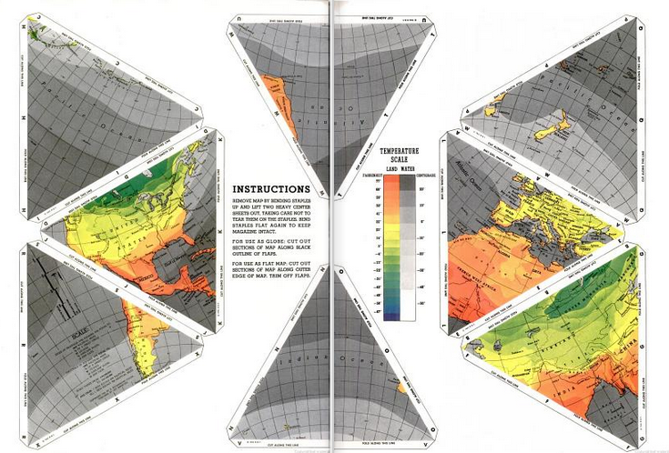
A look at American cartographic representations of WWII Europe, providing historical context for understanding our conception of global space.
Read MoreVisualizing War: Virtual Reality, Simulations, and Physical Battlefields

Predator Mission Aircrew Training System (PMATS) pilot/payload operator workstations | Photo: General Atomics
Simulations in computer games and virtual reality are radically altering the way the military prepares soldiers for war.
Read MoreCrossing the Line: A History of Medical Inspection at the Border
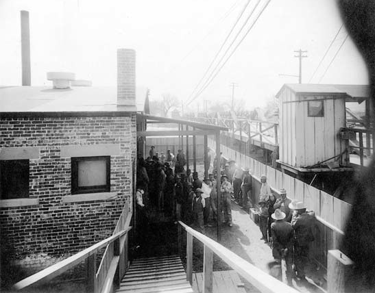
Mexicans quarantined at the Santa Fe Bridge Disinfection Plant, 1917 | USPHS, National Archives
In the early 1900s, medical inspection and photographic documentation ushered in a new set of surveillance procedures for state oversight at the U.S.-Mexico border.
Read MoreJohnston Island Saturday Night

Cake celebrating the destruction of all chemical weapons on Johnston Island, including Mustard Gas (H), Sarin (GB), and VX Nerve Agent | Photo : US Army
Artist Steve Rowell assembles a video piece documenting Johnston Island's past. Located 800 miles west of Hawaii, the site was transformed after numerous high altitude nuclear test launches during the 1960s and 70s.
Read MoreThe Simulators
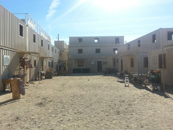
29 Palms Marine Corps Air Ground Combat Center | Photo courtesy of Incendiary Traces
After participating in the Incendiary Traces visit to the 29 Palms Marine Base, writer David Buuck contributes an excerpt from a novel about role players in a military training scenario.
Read MoreHarem Girls and Camel Races: Middle Eastern Fantasies in the Deserts of Southern California
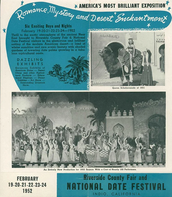
Riverside County Fair and National Date Festival Pamphlet, 1952 | Courtesy of the California History Room, California State Library, Sacramento, California
The towns in the eastern side of the Coachella Valley have long utilized romanticized portrayals of the Middle East to shape views of their own desert backyard.
Read MoreBattlefields of Santa Barbara

Detail map of Ellwood and Ellwood Offshore Oil Field, showing location of Luton-Bell Well No. 17, damaged by Japanese shelling Feb 23, 1942
How does modern war mark the California landscape? A single day's photographic record produced on the Southern California coast offers one compelling answer.
Read MoreThe Journey to Border Monument Number 140

Border Monument No. 2 - N31º47.032' W106º32.239', 2012 | Photo courtesy of David Taylor
David Taylor set out to photograph each of the 276 obelisks installed by the International Boundary Commission following the Mexican/American War.
Read MoreA Brief History of Border Walls

Graffiti and trash along the barrier that divides Israel from the Palestinians in West Bank | Courtesy of Goatmilk, via NYTimes.com
Incendiary Traces lists historical and contemporary border walls to provide some global and historical context for understanding Southern California's contested US/Mexico border.
Read MoreDrawing a Line: Encounters with the U.S.-Mexico Border
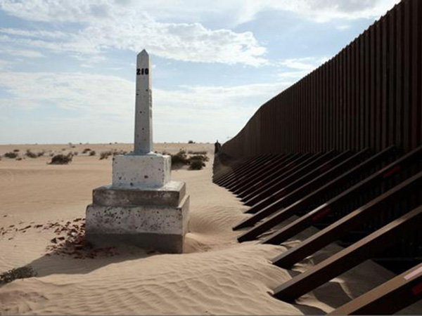
David Taylor, Boundary Monument No. 210, 2009. From the series Working the Line. Archival inkjet print, 31 x 24 in. | Photo courtesy of David Taylor
Susanna Newbury examines the history of the U.S./Mexico border and its geopolitical importance to the United States.
Read MoreLos Angeles: Camouflage and Contestation

Bird's eye view of Disneyland in Anaheim, California, 1958 | Courtesy of Stuff from the Park Blog
Art historian Jason Weems examines three mid-century constructions understood as staples of the California landscape: Disneyland, Lakewood, and the aerospace industry.
Read More'Even Our Palm Trees Are Cooler'

San Pedro palm being brought to Fifth Street and Central Avenue for depot, 1889 | Courtesy of USC Libraries Special Collections
Incendiary Traces examines the role that real estate and the railroad played in the advertisement of Southern California as a fertile tropical utopia in the late 1800s.
Read MoreHow a 19th Century Painting Transformed California's Desert World

(Left) "California Calls You", Union Pacific Railroad pamphlet, University of California-San Diego Special Collections, circa 1900 | (Right) "California for the Settler: The Natural Advantages of the Golden State for the Present Day Farmer", Pamphlet cover, Southern Pacific Company, circa 1910 | Courtesy of the California State Railroad Museum Library
In the late 19th century, Southern California's human and natural geography transformed as millions of new residents settled its semi-arid desert world, but artistic renditions of this region seldom get the attention of its northerly neighbors. But why is this the case?
Read More